Discover Tizimín, Yucatán: Beyond the Beaches and Pyramids
The state of Yucatán offers more than just Maya pyramids, colonial cities, and 256 kilometers (160 miles) of recreational beaches. It also boasts a vital agricultural and livestock-raising region covering approximately 450,000 hectares (over 1.1 million acres).
This rich inland area is centered around the bustling, yet small, city of Tizimín, Mexico. Located 200 kilometers (125 miles) west of Cancún and just 42 kilometers (26 miles) south of the Gulf of México port of Río Lagartos, the region is also famous for its wild flamingo colonies. From Tizimín, numerous cenotes (natural sinkholes), particularly Cenote Kikil, and spectacular Maya pyramids are easily accessible.
Tizimín: The Authentic Heart of Yucatán Culture
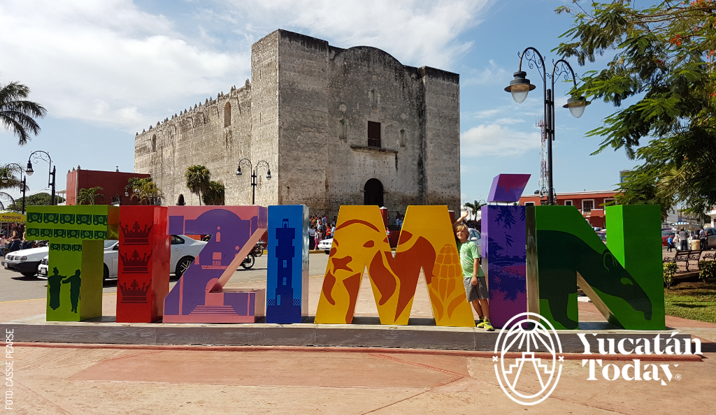
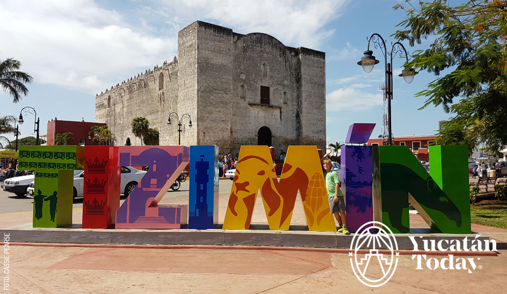 Tizimín—which translates to "Tapir or Danta," the sacred totemic animal of the Mayan Supreme God—was founded by Franciscan friars arriving with the conquistadors in 1544. It is also historically known as the "City of Kings" (Othe).
Unlike typical tourist hotspots, Tizimín offers an authentic glimpse into local Yucatecan life. Visitors will find comfortable hotels, varied restaurants, and travel agencies promoting local tours. More importantly, you'll see a vibrant mix of local people, cowboys (vaqueros), and Mayan indigenous residents, creating a unique and unified community. Experience genuine Yucatán travel and cultural tourism away from the crowds.
The Grand Feast of the Three Kings: Tizimín's Famous Festival
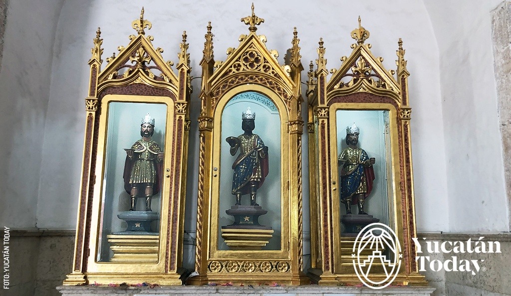 Every year, from late December to mid-January—with January 6th as the main day—Tizimín comes alive to commemorate its patron saints, the biblical "Three Kings" (Melchior, Gaspar, and Balthazar).
The festivities, known as the Feria de Reyes de Tizimín, include masses, pilgrimages (often spanning many miles), parades, traditional folk dances (vaquerías), and massive agricultural, livestock, industrial, and commercial exhibitions. A palenque (arena for events and entertainment) is also held for over a week. The devotion to the Reyes Magos is exceptionally strong, drawing pilgrims from great distances, making it the state's second-largest fair. The grand events run from December 28th to January 22nd.
Explore Ancient Mayan Wonders Near Tizimín
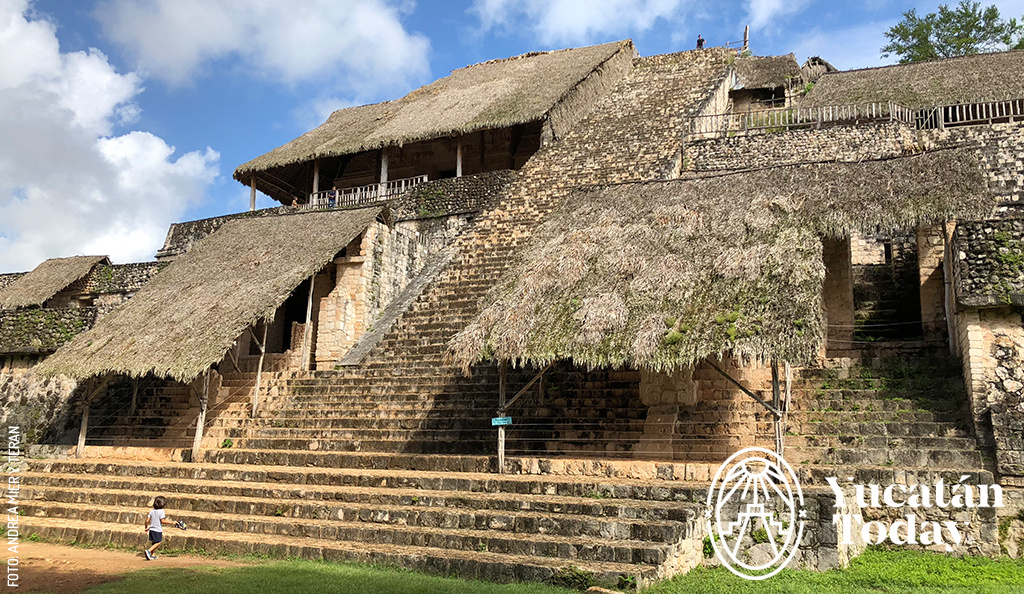 The nearby Maya pyramids are a key attraction for visitors seeking historical sites.
- Ek Balam: This site has grown in popularity as excavations and restoration work continue to advance. The massive, intricate stucco statuary at Ek Balam is truly incredible and a must-see for Yucatán archaeology enthusiasts.
- Kulubá: Located southwest of Tizimín, this lesser-known archaeological site offers a more secluded exploration of Mayan history.
The Fertile Heartland of Yucatán
The land surrounding Tizimín is notably flat and fertile, a contrast to the rest of the peninsula, where a thin layer of soil covers a massive limestone plate. This fertile ground, combined with the rainy season from June to October, sustains the pastures and grains for the robust cattle industry, as well as an active sawmill industry.
Precious hardwoods are sawn in Tizimín, including cedar, jabín, tzalam, bojóm, and sapote, reflecting the region's strong connection to its natural resources and Yucatán agriculture.
Tizimín: A Local Perspective on a Hidden Gem
From a different perspective, a local, Neydi Cardeña, shares fascinating insights into the largest municipality and second-most populated city in Yucatán: Tizimín.
Neydi describes Tizimín as a "jewel with 86 facets," highlighting the stability and tranquility of the municipality. Her extensive knowledge covers modern Maya culture, stunning geographical highlights (especially beaches and cenotes), and growing concentrations of archaeological remains (mostly unexplored). Driving along the municipality’s roads, cattle farms and ranches with modern irrigation systems flourish, forming the economic backbone of the region.
Hidden Treasures and Natural Wonders
Neydi singles out the places that excite her most:
![Cenote-en-San-Manuel-Km-11-en-Tizimin-by-Andrea-Mier-y-Teran]() Kikil: A small town home to a mystical ruined church and a tourist stop featuring a unique restaurant, a large open-mouth cenote, botanical gardens, and relaxation areas. Go for a swim, then relax in a hammock beneath a palapa roof.
Kikil: A small town home to a mystical ruined church and a tourist stop featuring a unique restaurant, a large open-mouth cenote, botanical gardens, and relaxation areas. Go for a swim, then relax in a hammock beneath a palapa roof.- San Manuel: This town has over 100 cenotes and has hosted long-term research projects funded by National Geographic.
- El Cuyo: A secluded, pristine beach so crystal-clear it’s often featured on magazine covers.
- Kulubá: An epic archaeological site unlike any other you’ve seen before.
Savoring Tradition in Colonial Tizimín
Though full of natural wonders, Tizimín has yet to feel the pressure of mass tourism, which is why you'll find pure mestizo culture in the city center. To truly eat like a local, you must immerse yourself in the traditional culinary scene.
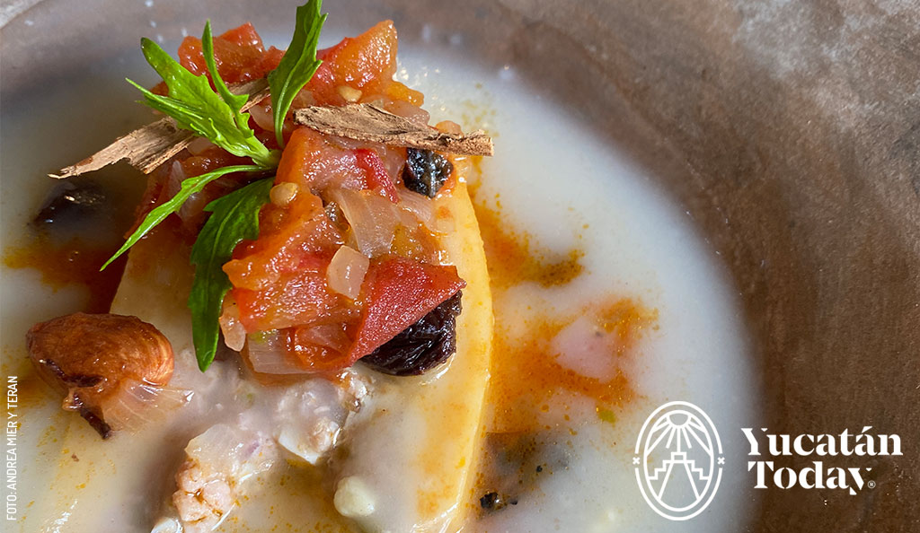 The foundation for a gastronomic experience in Tizimín is the iconic "Tres Reyes" Restaurant. Operating for over 40 years, the restaurant maintains a vintage vibe with 70s-style tables, chairs, and orange and brown accents. Enjoy a classic michelada alongside authentic interpretations of regional dishes.
A local favorite is the Queso Relleno (stuffed cheese), a complicated balance of white sauce, queso de bola (Edam cheese), and ground pork (garnished with the Lebanese touch of olives and raisins). Tizimín is also known locally for its high concentration of cattle farms and is home to dozens of shops dedicated to selling carne ahumada (smoked meat).
Imagine the Past: The Magic of Kulubá
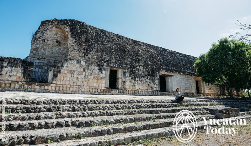 Almost an hour from Tizimín at the Kulubá archaeological site, the scent of damp stone and the sound of bat wings create an immediate, spiritual atmosphere. Climbing the palace offers an electrical sensation of standing in a truly sacred place without the distraction of crowds.
Archaeologists have been tracing Kulubá’s ancient timeline intermittently for decades, identifying it as a community relevant first to the regional giant, Ek Balam, and later as part of Chichén Itzá.
Awaiting Discovery
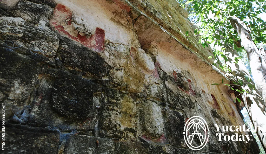
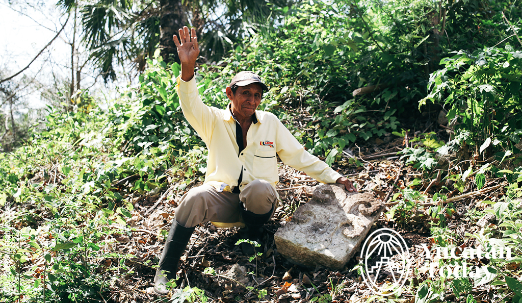
The state government has future plans to build necessary infrastructure to open the site for public tourism. Until then, the stones are carefully watched over by rancher-turned-archaeologist, Don Willy. He meticulously cares for the site, guarding the intricately carved rocks and offering quiet tours to adventurous visitors.
.webp)
The small, thatched-roof museum houses several breathtaking pieces of artwork.
Tips for Visiting Kulubá:
![Kuluba-Guardian-Don-Willy-4]() Directions: Follow our map of the Yucatán Peninsula to visit the site.
Directions: Follow our map of the Yucatán Peninsula to visit the site.- Roads: Be aware the path is rocky (but manageable).
- What to Bring: Wear comfortable adventure clothing, bring insect repellent to avoid ticks (highly recommended), and remember to offer a gratuity to Don Willy, the site's guardian.
How to Get to Tizimín
Planning your trip to Tizimín is straightforward:
- By Car (Free Highway): From Mérida, take the road to Motul and continue toward Tizimín. The road is in perfect condition and safe. The route takes approximately 2 hours and covers 170 km (105 miles).
- By Car (Toll Highway): From Mérida, take the toll highway to Valladolid. At kilometer 150, head north, following signs for 20 more kilometers (12 miles).
- By Bus: From Mérida, you can take a taxi colectivo (shared taxi) from the city center at Calle 65 x 52 and 54.
Author: Yucatán Today
Yucatán Today, the traveler's companion, has been covering Yucatán’s destinations, culture, gastronomy, and things to do for 38 years. Available in English and Spanish, it’s been featured in countless travel guides due to the quality of its content.
¡Receive the latest articles and much more from the best of Yucatán in your email!
Related articles
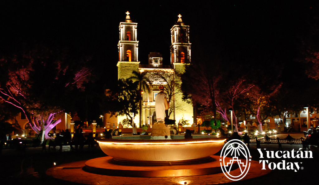
Valladolid
Valladolid, Pueblo Mágico Located halfway (two hours from each) between Mérida and Cancún, Valladolid, named "Pueblo Mágico" in August 2012, is a...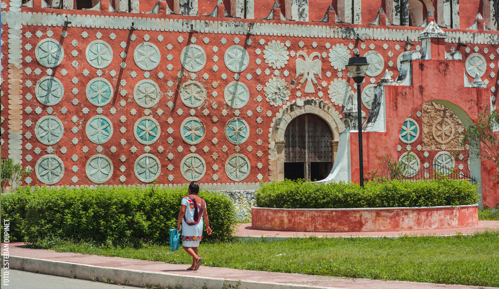
Uayma: Vice-Regal Beauty
There are destinations worth the journey: such is the case with Uayma, a small town located 15 km from Valladolid. It is known for its imposing and...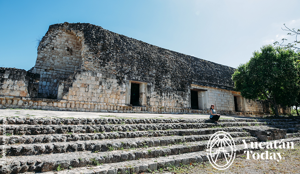


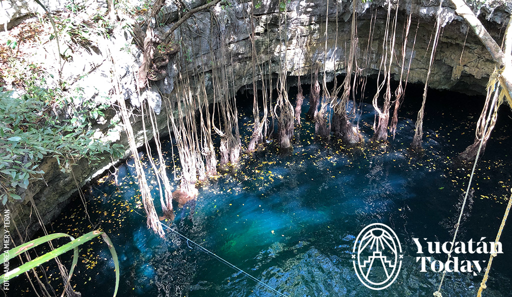 Kikil: A small town home to a mystical ruined church and a tourist stop featuring a unique restaurant, a large open-mouth cenote, botanical gardens, and relaxation areas. Go for a swim, then relax in a hammock beneath a palapa roof.
 Directions: Follow our map of the Yucatán Peninsula to visit the site.
