- Home
- Destinations
- Archaeological sites
Archaeological Sites
Although Maya culture is still alive today, there is no doubt that the remains of their great pre-Hispanic constructions are one of Yucatán’s most important attractions. Discover them here.
A glimpse at the Maya civilization
While there are records of the Maya people dating back to 8000 BCE, Maya culture as such began to develop socially around the year 2000 BCE. Throughout over 3,500 years, the Maya civilization grew, strengthened, and flourished without interruptions across a wide territory that spanned the entirety of what is now southern México, including the Yucatán Península, Tabasco, and the Chiapas highlands, as well as present-day Guatemala, Belice, El Salvador, and Honduras.
While today we think of them as a single civilization based on their common language, back then, city-states functioned as autonomous, independent entities, much like the ancient Greek nations did. The different Maya city-states rose, ruled, and fell in importance at different points, forming alliances and rivalries that also evolved with time. As a whole, the advancements the Maya achieved in subjects such as writing, math, and astronomy are outstanding and continue to surprise us to this day. Want to know more? Check out our article “A Brief Introduction to Maya Culture.”
The arrival of the Spanish in the 16th century irreversibly changed the course of history for the Maya. However, despite popular belief, the Spanish didn’t arrive in Yucatán to find traces of a lost civilization; the Maya people continued to thrive at the time of contact. As a matter of fact, even after being decimated by both the diseases the Spanish brought with them and a bloody conquest war, Maya people managed to preserve their identity, their language, and their culture for centuries up to this day. In other words, the “disappearance” of the pre-Hispanic Maya people is a myth. You can read more about it here: The Myth of the Maya Collapse and Disappearance.
With that in mind, let’s get into it: let’s go over the great Maya cities of old, and the ruins sites you can visit today.
The Maya archaeological sites of Yucatán
Out of the approximately 53,000 archaeological sites and ruins known in México, only 193 are open to the public. Of these, 15 are located in Yucatán (technically 18, but three are temporarily closed). While none receive more visitors than Chichén Itzá, each site you explore will reveal a different aspect and perspective of what pre-Hispanic Maya culture was like, offering you a truly unique experience.
- At Yucatán Today, we try to avoid referring to archaeological sites as “ruins.” This because, unlike European “ruins” (such as the Colosseum, the Parthenon, etc.), the Maya buildings you can visit are mostly excavations and restorations. They’re the work of hundreds of people, including archaeologists, anthropologists, historians, construction workers, architects, biologists, and custodians, just to name a few. The actual, unrestored ruins there are are closed to the public. However, we understand that the term “ruins” is used in good faith as a common way to describe these heritage sites.
- All archaeological sites in Yucatán are open daily from 8 am to 4 pm.*
- All sites (except for Yaxunah) are managed by México’s National Institute of Anthropology and History (INAH), which sets the federal admission fee for each.
- People over the age of 60 and under 13, people with disabilities, professors, and students are exempt from the federal admission fee.
- On Sundays, the federal admission fee is waived for Mexican residents who present proof of residency (INE, passport, or immigration form).*
- At some sites, in addition to the federal INAH fee, a state fee is charged.
- Yucatecos who can verify their residency are exempt from this additional charge.
- The state admission fee is also waived for seniors and children under 13, retirees, people with disabilities, and professors.
- The use of professional cameras with a tripod or GoPro requires an additional fee.
- To use drones, a permit must be requested in advance from INAH.*
- As of this edition’s publication, the sites of Balamcanché, Loltún, and Mayapán remain closed.
*Not applicable to Yaxunah
The 15 archaeological sites in Yucatán, by area
Southwest Yucatán: The Puuc Route
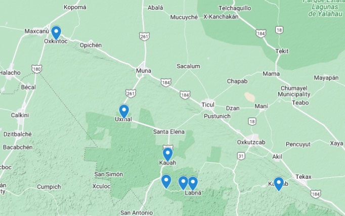
- Oxkintok
- Uxmal
- Kabah
- Sayil
- Xlapak
- Labná
- Chacmultún
Oxkintok
(pr. Oshkintók / osh-keen-TOCK)
- Meaning of “Oxkintok” in Maya: Its exact meaning remains uncertain; the current interpretation suggests "The City of the Three Flint Suns."
- Federal fee: $75 pesos (2025)
Before Chichén Itzá, there was Uxmal. Before Uxmal, there was Oxkintok. This pre-Hispanic city might just be one of Yucatán’s best-kept secrets. Unknown to the vast majority of travelers, both international and local, Oxkintok is located just minutes from the town of Maxcanú, near the border where Yucatán gives way to Campeche.
Surprisingly large for such an overlooked site, Oxkintok’s structures are quite different from those found along the Puuc Route. Since Oxkintok is older, it developed its own architectural style (Early Oxkintok and later Regional Oxkintok), which eventually evolved into what is now known as Proto-Puuc. You'll only find one building resembling the style seen in the rest of the Puuc Route—very horizontal with some cylindrical decorations. The site also features several examples of false or Maya arches built using different construction techniques.
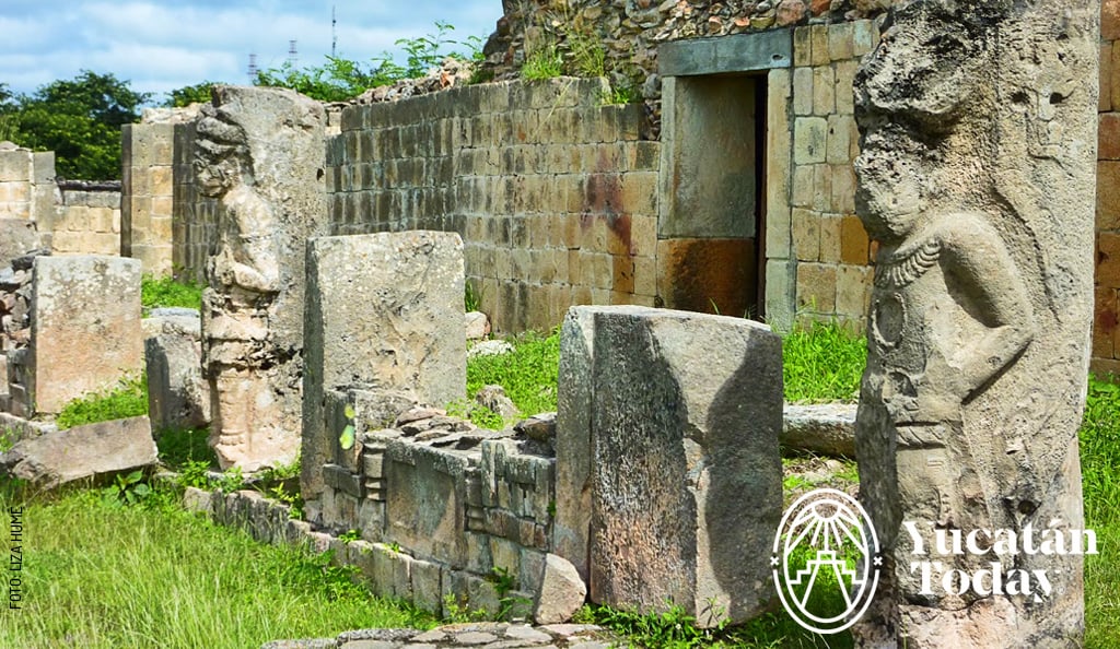
One of Oxkintok’s most remarkable structures is the Satunsat (also known as Tzat Tun Tzat in some sources) or "The Labyrinth." While it is not possible to explore its interior, it remains one of the few known Maya labyrinths. However, you can admire several stelae and carved stones depicting glyphs, warriors, and rulers. The site also boasts structures of various architectural styles and offers a privileged view of the Yucatecan Hills (Sierrita Yucateca) from its elevated plazas.
To make the most out of your visit, consider arranging a guided tour in advance. Víctor Chim Vergara, a certified local guide from Maxcanú, has been involved with the site (as well as the nearby Aktun Usil cave) for decades. His tours are enriched by his deep knowledge of the site, drawn from both personal experience and extensive research. It’s hard not to be captivated by his evident passion for this area. To book a tour with Víctor, contact him at Tel. 997 113 3910.
- A fun fact about Oxkintok: Just like in Dzibilchaltún, during the equinoxes (in March and September), you can witness the sun rising perfectly aligned with the center of the Plaza del Arco structure.
- Nearby sites and activities:
- Explore the Aktun Usil Caves – Though not an officially recognized archaeological site, they contain various ancient remains, including stone carvings, bone and ceramic fragments, and cave paintings. A guide is required; contact Víctor Chim (WA +52 997 113 3910) or Lourdes Canché (WA +52 999 214 1342).
Have lunch at the Ya’axche Ethnogastronomic Center, where you can enjoy an outstanding Yucatecan meal or even learn how to prepare it from scratch.
Uxmal
(pr: ushmál / oosh-MAL)
- Meaning of “Uxmal” in Maya: “The Three Times Built” or “Place Where Crops Are Harvested in Abundance.”
- Federal fee: $100 pesos
- State fee: $461 pesos (foreigners), $157 pesos (Mexican citizens)
- Parking fee: $116 pesos
There’s a reason why Uxmal is known as the jewel of the Puuc—as in both the region and the architectural style that bears its name. Unlike Chichén Itzá, which is often crowded with tourists, Uxmal offers a more pleasant visit and a glimpse into the architectural and artistic grandeur of the Maya civilization.
Even if you’re not familiar with architectural styles, it’s impossible not to be amazed by the intricate stonework in Uxmal. One of the most memorable sights from your visit might be the X-shaped lattice patterns forming countless stone diamonds on the façades of the buildings. These are believed to represent the woven patterns of petates (reed mats) on which the Maya, like many other Mesoamerican cultures, slept.
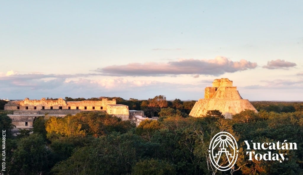
The star structure of Uxmal is undoubtedly the Pyramid of the Magician, which impresses not only with its height but also with its oval shape, setting it apart from the straight lines that dominate other sites.
But don’t stop at this breathtaking view (which is the first thing you’ll see upon entering the site). Continue your tour to visit The Nunnery—named for its resemblance to a cloister—and admire the intricate decorations on its façades. Climb up to the Governor’s Palace and experience the optical illusion that makes the stairs seem to "disappear" on the way down. Scale the Great Pyramid and explore the recently reopened area where El Palomar (The Dovecote) is located, named after the birds that once took shelter in its decorative crestwork. By the end of your visit, it’ll be hard to choose a favorite spot!
- A fun fact about Uxmal: The elaborate crest of The Dovecote casts the shadow of a slithering serpent along the base of the building during the winter solstice, around December 21.
- Video mapping: $355 - $755 pesos. More information: Ecos de Uxmal.
- Nearby sites and activities:
- Just a few meters from the site, you'll find Choco-Story, an eco-museum dedicated to cacao—covering everything from its pre-Hispanic uses to today’s chocolate industry. It also serves as an ecological reserve and an animal rehabilitation sanctuary.
- The nearby town of Santa Elena has a small museum. Originally dedicated to mummified bodies discovered during an excavation, it now offers insight into the Maya Social War, more widely known as the Caste War.
Kabah
- Meaning of “Kabah” in Maya: “Lord of the Powerful Hand” (K’ab Aj)
- Federal fee: $75 pesos
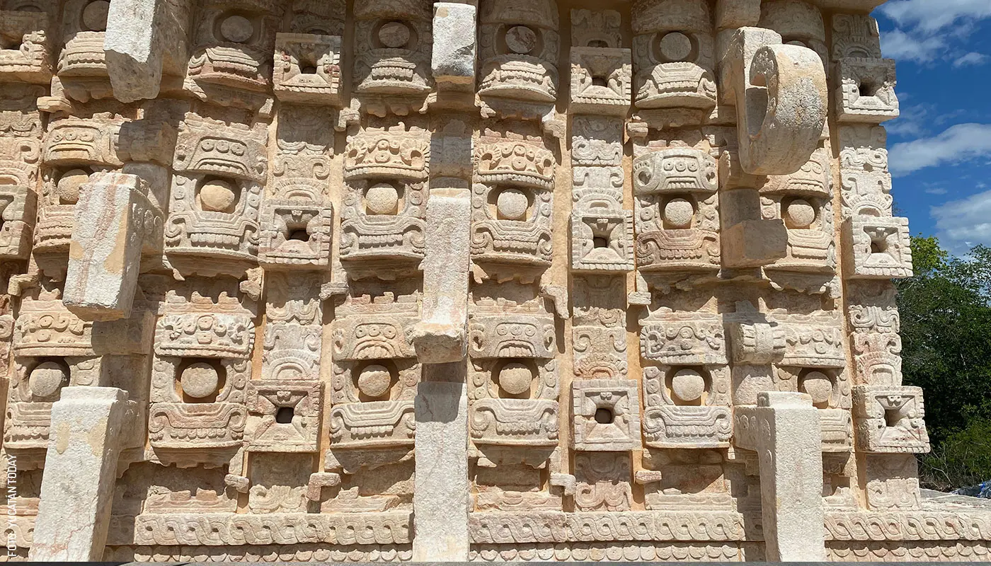
Kabah is the second most visited archaeological site on the Puuc Route (after Uxmal). By far, its most famous attraction (perhaps rightfully so) is the Codz Pop (also known as Kots’ Poop, or the rolled-up mat). This building’s western façade was once completely covered with masks that were long attributed to the god Chaac (the rain god). However, there is an ongoing debate about whether these masks actually represent Chaac, the creator god Itzamná, or Witz, the god of the earth or mountains. While not all the masks have survived to this day, the structure still boasts hundreds of them that are definitely worth seeing for yourself. Take a closer look at the fine detail of the sculptures (each mask is composed of 30 individually carved pieces) and remember that all this work was done without the aid of metal tools.
Just because Codz Pop is the most famous doesn’t mean it’s the only thing to see. As you continue your tour, you'll encounter more examples of impressive stone-carving skills in the form of delicate sculptures and mosaics, all part of monumental elevated plazas.
Crossing the road (very carefully, as it is a highway), a short walk will take you to the Arch of Kabah. While not as ornate as other structures at the site (or other arches in the region, like the one in Labná), this arch stands out because of its size: built on a platform raised 4 meters (13 feet) above the ground, its interior height is 6.5 meters (21.3 feet). It has been hypothesized that the arch may have originally featured a crest, which would have made for a total height of nearly 14 meters (45.9 feet), making it an easily visible landmark marking the entrance to the city.
- Fun facts about Kabah:
- Unlike most archaeological sites, which got their current names after the arrival of the Spanish, the name Kabah is pre-Hispanic, as it is mentioned in the Chilam Balam of Chumayel (one of the few surviving Maya books).
- According to the legend of the Uxmal dwarf, the sorcerer or magician who built the pyramid in a single night was originally from the neighboring city of Kabah.
Sayil
(pr. sigh-EEL)
- Meaning of “Sayil” in Maya: “Place of the Leafcutter Ants” (Saayil)
- Federal fee: $70 pesos
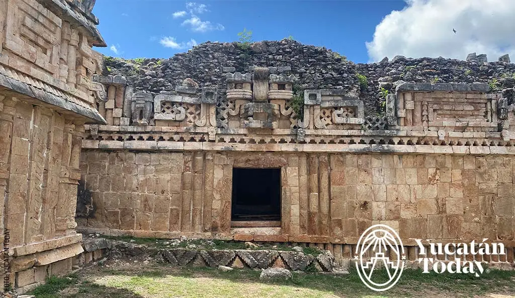
Another tragically under-visited site, Sayil is full of surprises. The first thing you'll see is a wonderful stela at the entrance of the site. However, the most impressive will undoubtedly be the Grand Palace or North Palace.
The Grand Palace is a structure 85 meters (279 feet) wide and three stories high. It’s not possible to enter any of its 90 rooms, but viewing the complex from a distance gives a great idea of how magnificent it must have been at its peak. Today, the different areas of the palace show varying degrees of preservation and restoration, offering a cross-sectional view of its interior.
Other notable structures in Sayil include El Mirador (an elevated construction with impressive crestwork) and the Temple of the Jambs, which, being semi-buried, allows a close-up view of the carvings on the stone doorframes.
A fun fact about Sayil: A few meters from the Palace, if you take a path off to the side, you’ll find another stela known as the “Lord of the Phalluses” (Nojoch Keep, pronounced no-HODGE kep), where Nojoch means large, and Keep is the term for the male reproductive organ. Needless to say, if you or your companions are uncomfortable with oversized anatomical representations, it’s best not to take this detour. However, it’s important to remember that for the Maya, fertility (both of the land and offspring) was a topic of utmost importance—especially in the Puuc region, where the scarcity of cenotes and the complete absence of rivers left the population and their access to water entirely at the mercy of the gods. The presence of monuments and phallic representations meant to stimulate rainfall is one of the consequences of this reality.
.jpg)
Xlapak
(pr. Shlapác / shh-lah-PACK)
- Meaning of “Xlapak” in Maya: “Old or Deteriorated Walls” (Xla’ Pak’)
- Federal fee: $75 pesos
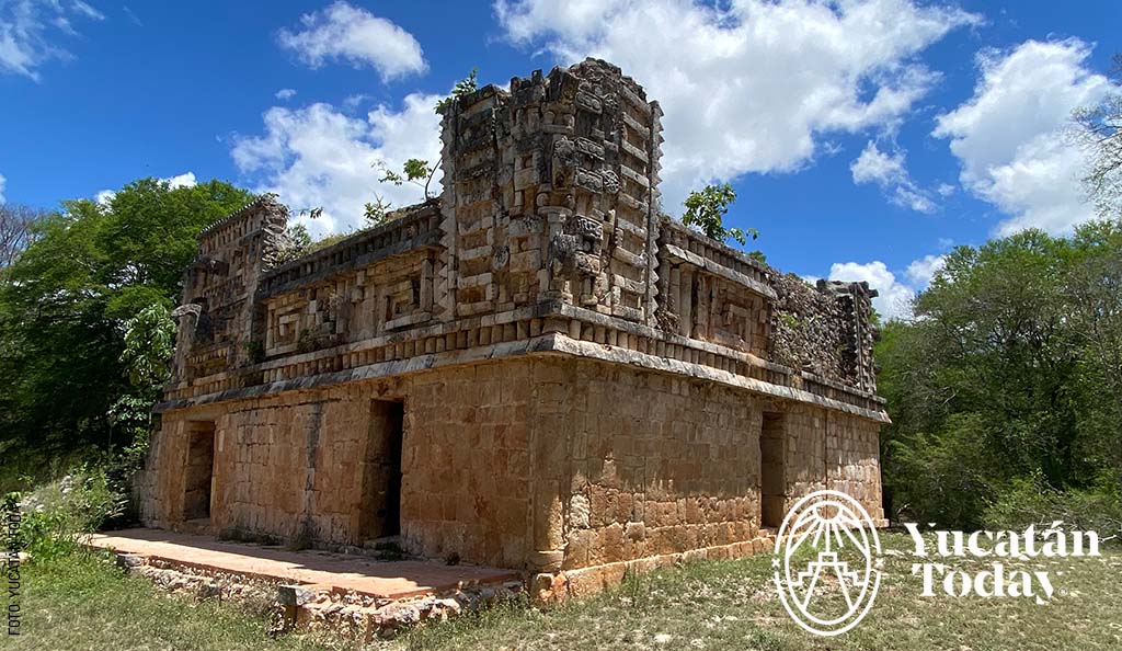
Of all the sites in the Puuc region, Xlapak is the smallest and also the least restored. The entire site tour is a 900-meter circuit that takes you around the various buildings that have been uncovered.
The best-preserved structure here is the Palace, where you can observe the fine details of its crestwork. However, I would argue that the main attraction of the site is precisely its natural state, which allows you to appreciate not only the skill of the pre-Hispanic Maya who built these monuments centuries ago but also the work of the current archaeologists who painstakingly study and reconstruct them to show us their original splendor.
- A fun fact about Xlapak: You’ll notice that one of the buildings in the circuit has several small plastic "mosaics" with black and white triangles attached to it. These were placed there by the site’s researchers to monitor the “settling” of the structure. In other words, they are used to detect whether the building is deforming over time so that any issues can be addressed in time to prevent it from collapsing.
Labná
- Meaning of“Labná” in Maya: “Old or Deteriorated House” (Laab Naj)
- Federal fee: $75 pesos
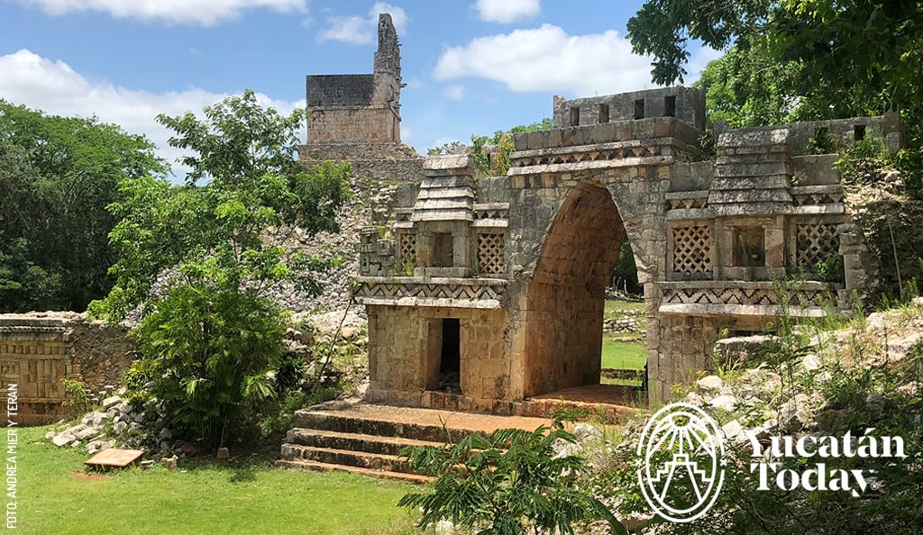
Labná offers a unique opportunity to explore a typical Puuc building and closely appreciate its various features. You'll see junquillos (stones carved into cylindrical shapes) and stone “knots” that evoke the construction of traditional Maya houses, as well as Maya arches and masks…and at this point, the visit is just beginning, at the building known as The Palace.
A sacbé (ancient Maya road) will lead you, however, to Labná’s most iconic structure: the Arch. Highly ornamented, the Arch of Labná is considered the masterpiece of the Puuc Mosaic style. If you get closer, you’ll be able to distinguish traces of paint in its recesses, which gives an idea of its original vibrant colors. The interior height is 4.80 meters (15.7 feet), but it’s actually taller, as it sits on a platform that you must climb to pass through. It is believed that the Arch marked the division between the public plaza and the more private inner courtyard. Though not on display, remains of the crest that topped the Arch have been found, making it appear even more monumental about 1500 years ago.
- Fun facts about Labná:
- Between the Arch and the Palace, you’ll see the Lookout Point, an elevated structure with a more primitive (less ornamented) style than the rest of the site. You’ll likely notice the slits in its crestwork (the same height as the building itself); these slits allow air to circulate freely, protecting the structure from damage during storms and hurricanes.
The Palace has 70 chultunes (cisterns for collecting rainwater) that are not visible.
Chacmultún
- Meaning of “Chacmultún” in Maya: “Mounds of Red Stone”
- Federal fee: $75 pesos (2025)
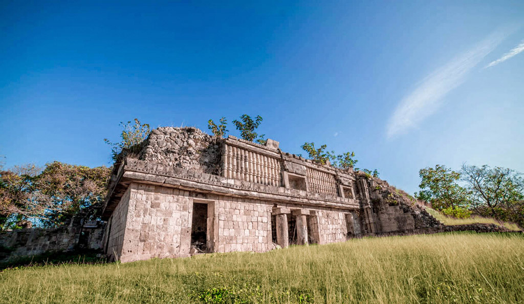
If you’re in Tekax or if the southern routes are calling you, Chacmultún is a perfect stop along the way. This archaeological site is one of those places that rarely appears on the more well-known tourist routes, but once you discover it, you’ll wonder how it went unnoticed. Located 130 km (81 miles) southeast of Mérida and about 10 km (6 miles) from Tekax, it is the last stop on the Puuc Route.
The site covers one square kilometer and has four main groups: Chacmultún, Central, Cabalpak, and Xethpol. During its peak, between 600 and 1000 CE., it was the most important city in the eastern part of the Puuc region, with a population of up to 15,000 people. After its decline in 1500 CE, the site was abandoned until it was rediscovered in 1875 by Austrian explorer Teoberto Maler.
The Chacmultún group is the largest and best preserved. Here you’ll find El Castillo, an imposing structure with monolithic columns and geometric details in the stones that not only showcase the incredible skill of the Maya but also reflect part of their worldview, such as their respect for water, a key element in their culture. Another interesting point is Building 3, where you can still see remnants of murals depicting scenes of encounters between different groups of people. Although time has left its mark on the walls, you can still distinguish details in shades of red and blue.
If you continue exploring, you’ll come to Cabalpak, or “sunken terrace,” a group of structures that seems like a single one due to the way they are arranged. At the end of your tour, Xethpol, which means "cut-off head" in Maya, offers a stunning panoramic view of the entire region, perfect for enjoying the breeze after the walk.
- Fun facts about Chacmultún:
- The stones at Chacmultún have a peculiar characteristic: they contain microorganisms that, with exposure to air and water, cause them to turn reddish. In fact, the name Chacmultún comes from this phenomenon.
- Along with Oxkintok and Uxmal, Chacmultún is one of the few sites on the Puuc Route that features a Maya Ball Court.
- Nearby sites and activities:
- The Magical Town of Tekax awaits you with endless opportunities to explore Yucatán both inside (in its caves) and outside (with zip-lining, rappelling, hiking, etc.), offering different levels of difficulty suitable for the whole family.
.jpg)
North and Center of Yucatán
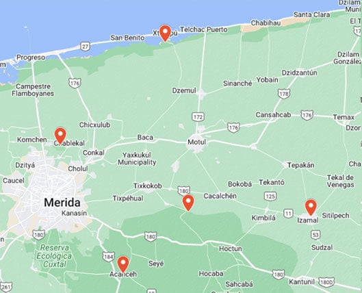
- Xcambó
- Dzibilchaltún
- Acanceh
- Aké
- Izamal
Xcambó
(pr. shcambó / shh-cam-BEAU)
- Meaning of “Xcambó” in Maya: There are two possible meanings: “Place Where Exchanges are Made” or “Celestial Crocodile”
- Federal fee: $100 pesos
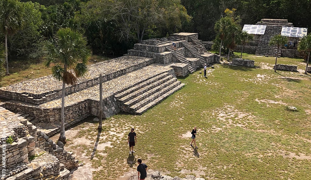
Xcambó is the only known archaeological site on the coast of the state of Yucatán. It is considered one of the oldest archaeological sites, as it began to be populated during the Late Preclassic period (around the year zero of the common era) and was inhabited until around 700 CE, when it began to decline, likely due to changes in trade routes. However, its fame was such that we know that during the Postclassic period (from the 12th century until the arrival of the Spanish), pilgrims visited it to offer tributes.
Xcambó is a testament to the Maya’s mastery over their environment, as the settlement took advantage of access to fresh water on an islet along the coast. We know that it went from being a small fishing village to an important commercial and salt-producing port, with connections to regions as distant as Veracruz, Petén in Guatemala, and Belize. It came to control an extensive territory, as there are sacbés (Maya roads) connecting it to nearby saltworks in Xtampú, Misnay, and Providencia, which depended on the city.
Another detail that archaeologists have confirmed is that Xcambó meets the characteristics of a commercial port, as a wide range of non-local and prestigious products has been found there. What remains unclear, however, is the nature of its possible contact with Izamal during the Early Classic, as the site shows clear architectural affiliation with that center.
- A fun fact about Xcambó: Xcambó continued to be a center of worship even after it was abandoned. Today, within the site, there is a Catholic chapel, which houses a highly venerated figure known as “Our Lady of Xcambó.”
- Nearby sites and activities:
- Visit the Xtampú salterns, just a few meters from the site, to go kayaking and learn about the salt extraction process.
- Explore the mangroves of San Crisanto and swim in a crystalline cenote. Book at 999 926 0236 or 991 105 3710.
- Enjoy a day at the beach in Telchac Puerto.
Dzibilchaltún
(pr. tsibi-chaltún / tsee-beel-chal-TOON)
- Meaning of “Dzibilchaltún” in Maya: Place where there’s writing on flat stones (ts’íib il chaltun)
- Federal fee: $100 pesos
- State fee: $261 pesos (foreigners), $127 pesos (Mexican citizens)
Freshly reopened after a few months, the Dzibilchaltún archaeological site is sporting a brand-new visitor center, where a cafeteria and craft shop are expected to open later. As of this writing, in February 2025, the Museo del Pueblo Maya is closed, and the state fee is not being charged.
Dzibilchaltún is one of the oldest settlements in northern Yucatán; it is believed to have been inhabited as early as 600 BC, and at its peak, it covered approximately 20 km2, which is about the size of the city of Mérida today. The city was laid out concentrically. In the center were the most important buildings, including the homes of the elites, such as rulers, priests, and military leaders. In the middle circle lived the more affluent class, including artisans and merchants, and in the largest and most distant area were the peasants and their milpas (cornfields).
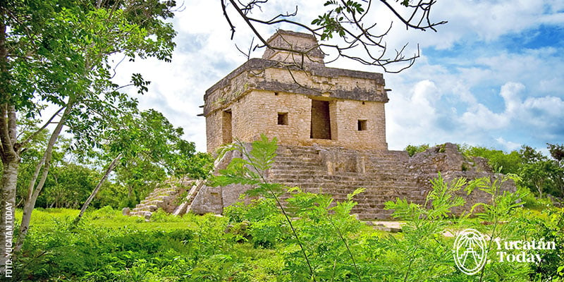
The most famous structure in Dzibilchaltún is the Temple of the Seven Dolls. This distinctively shaped building functioned as a celestial observatory: its side windows mark the sunrise at its north and south extremes (i.e., during the summer and winter solstices). On the days around the spring and autumn equinoxes, the sun can be seen "crossing" its central doorway at dawn. On those days, the INAH (National Institute of Anthropology and History) usually opens the site at 5 a.m.; keep an eye on our social media to verify the exact dates (there are sometimes more than one) and be sure to arrive early to avoid crowds.
Other interesting sights within Dzibilchaltún include the Open Chapel (built and used by the Spanish between 1560 and 1610), one of the longest structures in the Maya world, and the beautiful Xlacah cenote. The Dzibilchaltún archaeological site is located in a protected federal area, so swimming in the cenote is not allowed; however, depending on the time you visit, you may see fish, turtles, and even birds taking advantage of the refreshing water.
- A fun fact about Dzibilchaltún:
- The Xlacah cenote is between 1.5 and 180 feet deep.
- Nearby sites and activities:
- Go farther north and visit the port of Progreso, which offers beautiful beaches, the Meteorite Museum, restaurants, activities, and much more.
- Back in Mérida, visit the Gran Museo del Mundo Maya to find out more about this first nation, from ancient times to the present day.
Acanceh
(pr. akanké / ah-can-KAY)
- Meaning of“Akanceh” in Maya: “Deer’s Moan or Cry” (áakam kéej)
- Federal fee: $75 pesos
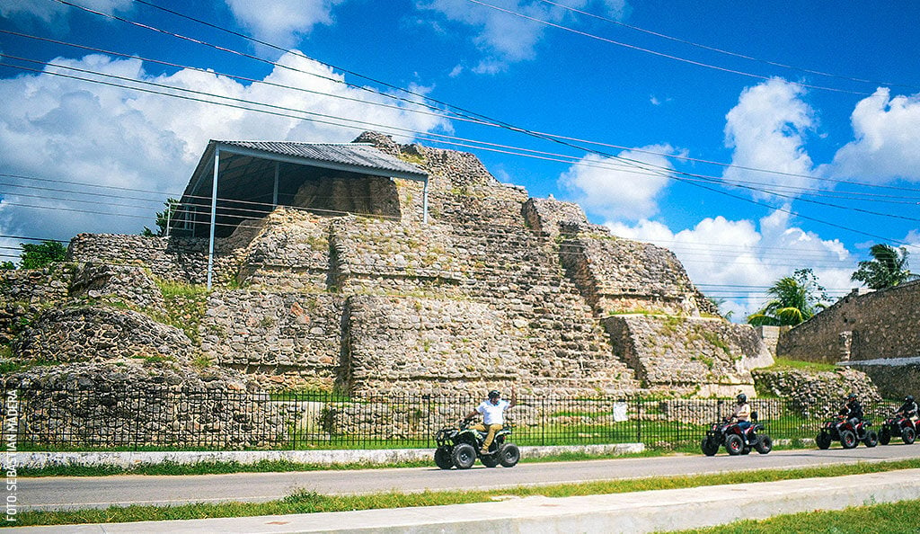
Acanceh (remember, it’s pronounced ah-can-KAY) is, along with Izamal, one of the Yucatecan towns where monumental Maya constructions coexist with colonial and contemporary Mexican buildings. Around 300 pre-Hispanic Maya remains have been discovered in the current town of Acanceh. From these, we know that the city was of great economic, religious, and political importance, covering an area of around 3 km². Of all the structures found in Acanceh, the three most visited are also the most monumental: The Pyramid (also known as the Pyramid of the Masks), the Stucco Palace, and the Observatory.
The Acanceh Pyramid is famous for the six monumental masks (ranging from 2.25 to 3.5 meters or 7.4 to 11.5 ft tall) that flank its staircase. Originally, there were eight, but the first two, facing the street, were damaged and lost due to inadequate protection after their discovery in 1908.
It is believed that the masks represent the different aspects of Kinich Ajaw, the Maya sun god, and that the lower faces represent Wits, the god of the mountains. These masks are estimated to have been carved during the Early Classic period, and it is thought that they functioned as public incense burners, not only to recreate key events in Maya creation mythology but also to provide sustenance for the gods through the smoke that emanated from them.
- Fun facts about the Pyramid of Acanceh:
- If you visit during opening hours and find the gate closed, head over to the INAH kiosk at the corner of Calles 20 x 21 (in front of the main park); the guards will open the gate for you and share the history of the site.
- The structure we see today is not the same one the Spanish encountered upon their arrival. Remember that the Maya often “remodeled” their buildings by constructing new layers on top of them; it is believed that the more superficial stones were used in the colonial buildings of the city.
- Nearby sites and activities:
- Cool off in the Homún cenotes.
- For a more extreme adventure, head to the Telchaquillo cenotes.
Aké
(pr. ah-KAY)
- Meaning of “Aké” in Maya: Bejuco or guaco (aak’)
- Federal fee: $75 pesos
Founded around 300 BCE, the city of Aké reached its peak between 600 and 1200 CE. Although the San Lorenzo Aké henequén plantation (now a decorticator) was built over the site, several of its pre-Hispanic buildings are still visible. The predominant style here is megalithic, characterized by the use of large stone blocks; however, in later stages, some structures were modified with mosaic-style masonry, traditional of the Puuc architectural style.
The area that can currently be visited is considered to be the central part of the settlement. This consists of a plaza of approximately 25,000 square meters (269,000 square feet); in the center, you’ll find a stela, surrounded by several monumental structures.
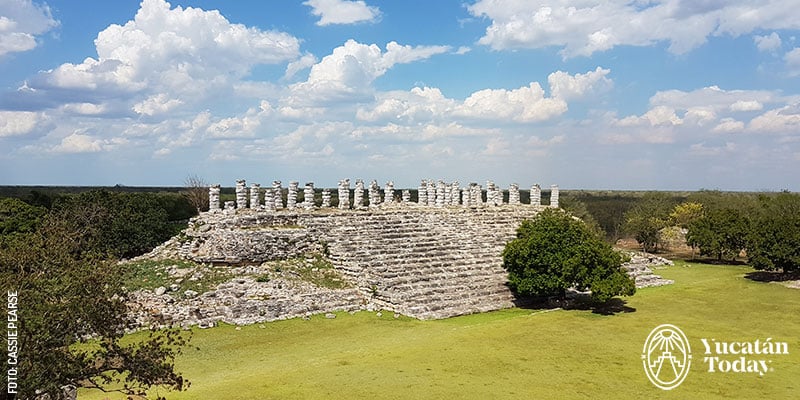
Among them, the most notable is Las Pilastras, at the northern end: a platform 102 meters (334 feet) long and 36 meters (118 feet) wide, with a top that houses 35 pilasters up to 4.30 meters (14 feet) tall. It is believed these pilasters likely supported one of the largest wood and palm roofs in Mesoamerica.
Climb to the highest structure on the site (next to Las Pilastras) and take some time to enjoy the view and breeze; continue exploring the site, and you may come across the sacbé that led directly to Izamal or meet Jorge Pech, the site’s custodian, who will be happy to tell you about the site’s significance in pre-Hispanic times and share his experience of caring for the site for over 30 years.
- A fun fact about Aké
- Aké has several sacbés that connect various structures, but it also has the second longest sacbé known to date. At approximately 32 km (20 miles) in length, it connects Aké to Izamal.
- Nearby sites and activities:
- If you're hungry, ask for the Mito Balam diner; they offer traditional Yucatecan lunches at very affordable prices.
- The adventure can continue: contact José Martínez Gamez, a worker at the plantation, who can give you a small tour of the property and its surroundings to explain the henequén decortication process. Tel. 999 126 4199
Izamal
As with Acanceh, the pre-Hispanic remains of Izamal are permanently intertwined with the Spanish colonial heritage and modern Mexican life. As a Maya city, its peak began in the Proto-Classic period (150–250 CE) and its decline occurred in the Early Postclassic (1000–1200 CE), when Chichén Itzá began to rise in prominence. From its main plaza, four sacbés (pre-Hispanic roads) extended toward each cardinal direction; of these, only the ones connecting to the archaeological site of Aké (32 km to the west) and Kantunil (22 km to the south) remain today.
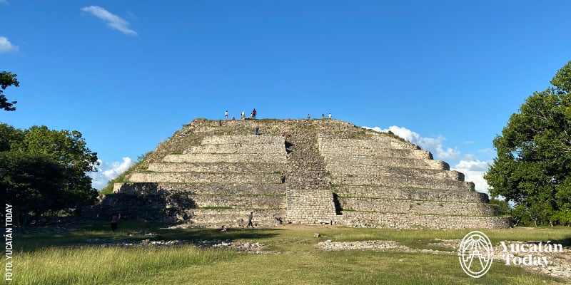
There are five sites you can visit in Izamal. The most notable is Kinich Kakmó, the third tallest pyramid in México. It is precisely its size that leads experts to believe that Izamal was one of the most important pre-Hispanic cities in Yucatán. The pyramid is named after an aspect of the Maya sun god, Kinich Ajaw, called Kinich Kakmó, which translates as “fire macaw with a sun face.” Kinich Ajaw was also connected to the god Zamná or Itzamná, who is the namesake of the city, as it is said that, in his human form, he lived and died there.
The other four structures you can visit are Habuk, T’u’ul (the rabbit), Itzamatul, and Chaltún Ha.
Plan your visit to Izamal with our guide: The Magical Town of Izamal
- A fun fact about Izamal
- Although there is no visible trace of it, one of the most visited Maya bases to this day is Pap-hol-chac: the Convent of Saint Anthony of Padua is built on top of it.
Eastern Yucatán
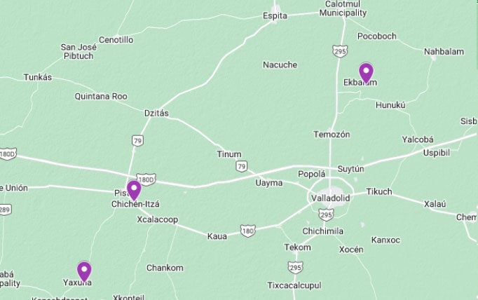
Yaxunah
- Meaning of “Yaxunah” in Maya: “Green House” (Ya’ax u naj) or “First House” (Yáax u naj)
- Fee (established by the community): $100 pesos (general, every day)
The archaeological site of Yaxunah is quite special. It is the only site open to the public that is not managed by the National Institute of Anthropology and History (INAH) of México. This is because the people of Yaxunah chose to manage it themselves, ensuring that the income generated by visitors stays within their community.
The excavations and restorations at the site were carried out by foreign universities and institutions, and it is the local Yaxunah people who maintain the site, keeping it clean and suitable for visits. You’ll find several structures, including a Grand Ball Court, several pyramids, and an observatory. You’ll also see the beginning of what is considered one of the longest sacbés (Maya roads) in the Península, connecting Yaxunah to the city of Cobá in what is now Quintana Roo. This sacbé, approximately 100 km (62 miles) long, is believed to have been built around 600 CE.
- A fun fact about Yaxunah: Yaxunah and Cobá were allies; in fact, it is believed that the population of Yaxunah was decimated by the city-state of Chichén Itzá when it went to war with Cobá around 950 CE.
- Nearby sites and activities:
The Yaxunah community offers several ecotourism projects; the most famous is their cochinita pibil workshop, but you can also rent bicycles, visit a cenote, or simply enjoy a meal there.
Chichén Itzá
- Meaning of“Chichén Itzá” in Maya: “At the mouth of the well of the Itzá”
- Federal fee: $100 pesos
- State fee: $548 pesos (foreigners), $190 pesos (Mexican citizens)
- Parking fee: $116 pesos
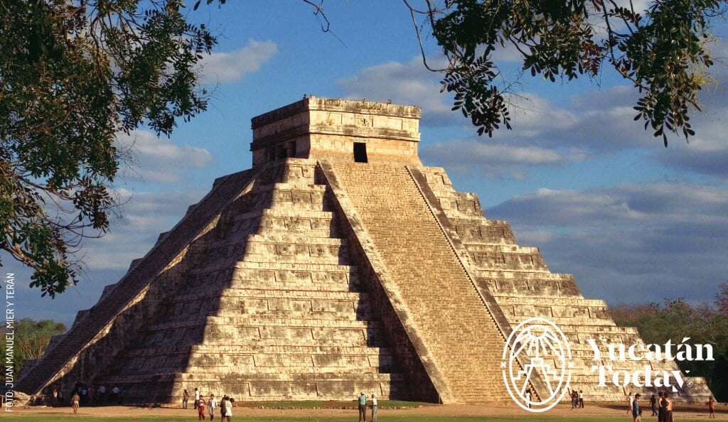
Declared a World Heritage Site since 1988, Chichén Itzá is one of the most visited archaeological sites in the Americas—and especially in Yucatán. Its main structures (such as El Castillo or the Kukulcán Pyramid and the Observatory) are famous worldwide, to the point that they have become icons of Maya and pre-Hispanic culture in general.
The entire site is quite extensive (you'll walk about seven kilometers or 4 miles if you decide to explore it all), but your visit can be as brief as you like. Currently, the first structure you’ll encounter upon entering is the most famous (El Castillo); on the other hand, the furthest (and quieter and more peaceful) complex is found in Chichén Viejo. Up until now, this part of the complex is only open for visits on Thursdays, Fridays, and Saturdays, and requires prior reservation.
To plan your visit to this wonder of the world in more detail, check out our complete guide to Chichén Itzá.
A fun fact about Chichén Itzá: A section of the site, known as Chichén Viejo, is available to visit only in small groups, by reservation, from Thursday to Saturday. Reserve your access in advance by phone (985 851 0137) or email (reservasserieinicial@gmail.com).
Ek Balam
- Meaning of “Ek Balam” in Maya: “Jaguar star” (eek’ balam) or “black jaguar” (éek balam)
- Federal fee: $100 pesos
- State fee: $461 pesos (foreigners), $127 pesos (Mexican citizens)
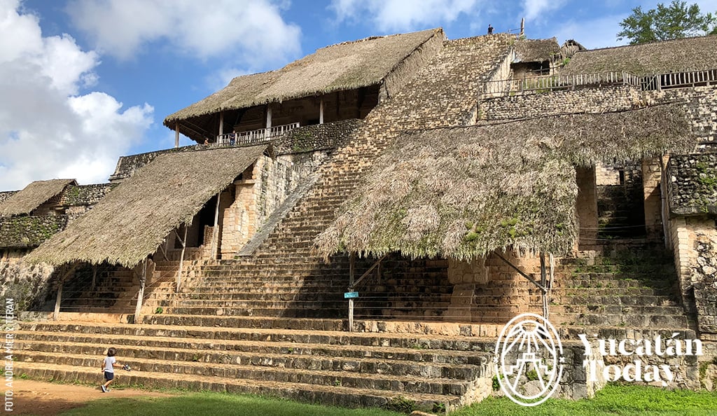
This archaeological zone, located north of Valladolid, features some of the most impressive examples of sculptures and stucco in Yucatán. Visitors can climb the main temple of the Acropolis and see figures of winged warriors and a large earth monster whose open mouth represents the entrance to the underworld.
The X'Canché cenote is nearby, offering a place to swim and cool off. It's about a 2 km walk, or visitors can rent bicycles or hire a bici-taxi to get there. The site has a restaurant, and the town of Temozón is also nearby, known for its longaniza sausage and smoked meats.
- A fun fact about Ek Balam: It may be hard to believe, but the Acropolis façades are original; they were covered and protected by a wall for centuries, until their discovery around the year 2000.
- Nearby sites and activities:
- Marvel at and, if so inclined, swim in the X'Canché cenote.
- Visit Temozón to see the temple of San Agustín, which dates from the 18th century, enjoy the legendary Temozón smoked meat, or buy wooden furniture.
Artículos relacionados
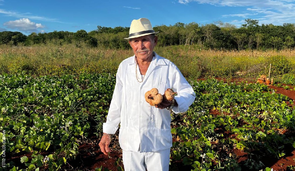
El mito del colapso de la civilización maya
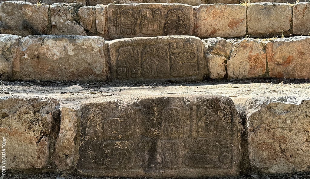
Una breve introducción a la cultura maya
Recorre un mundo de maravillas en Expo TlaquepArte
Artículos relacionados
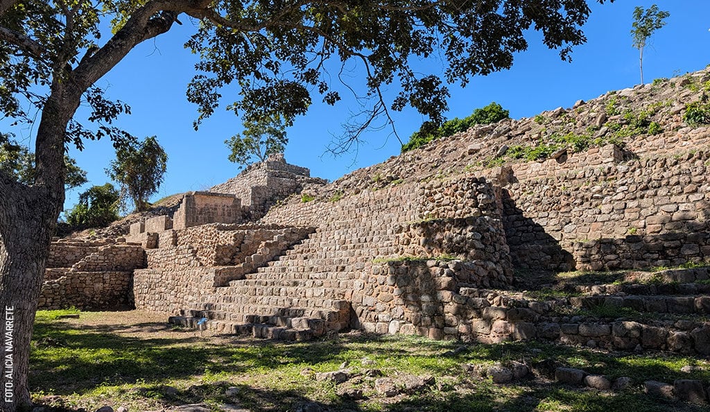
Oxkintok
Chacmultún, a Maya legacy


